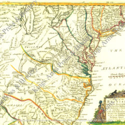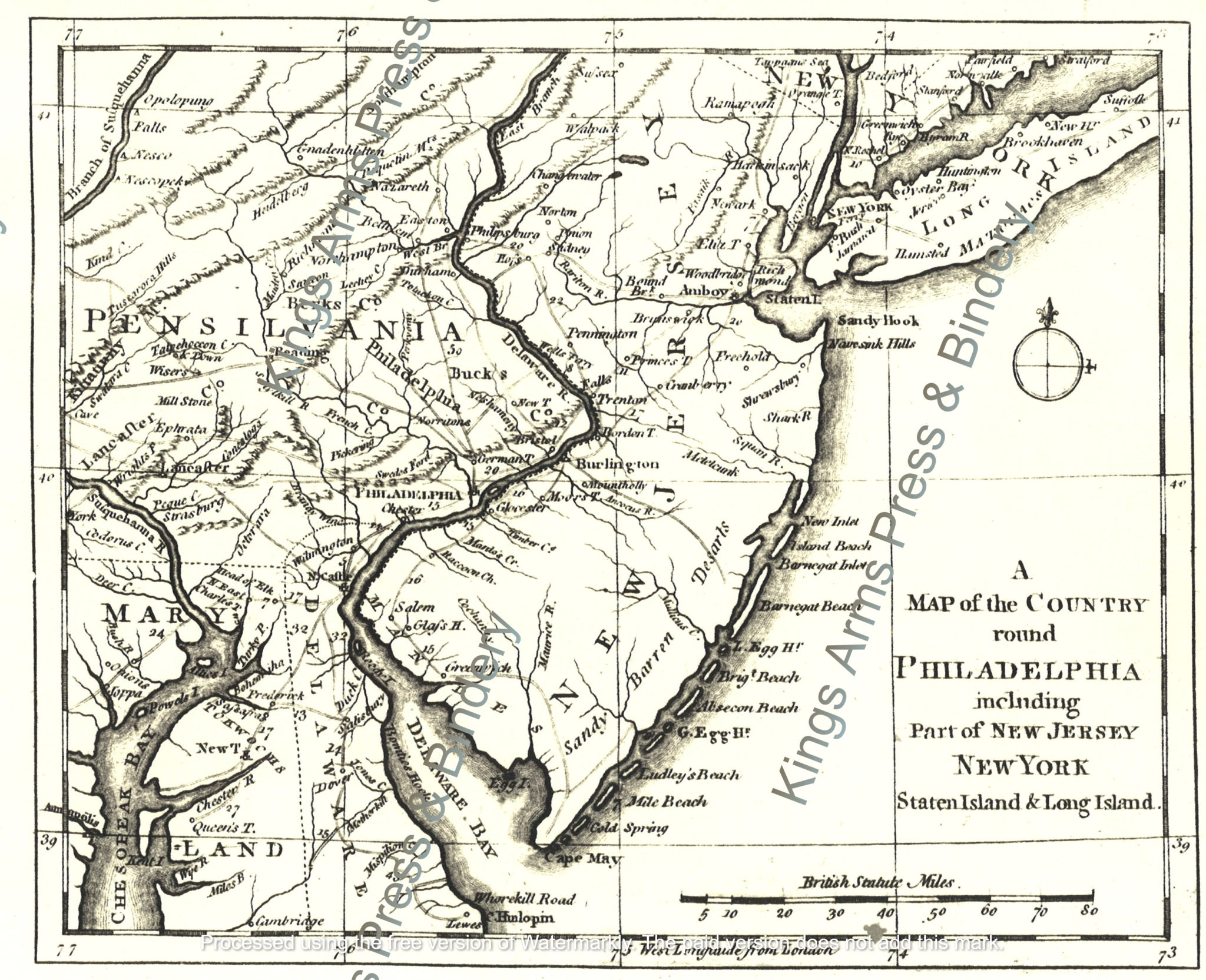
A Map of the country round Philadelphia including part of New Jersey, New York, Staten Island, & Long Island
$5.00
This map of eastern Pennsylvania, New Jersey, and the area around New York City originally was published in The Gentleman’s Magazine of September 1776. An accompanying article explained: “It [the map] comprehends that part of America which is now the chief object of the British arms. Should New-York be suddenly reduced, it is more than probable that Philadelphia will be next attacked, as the distance from one city to the other is little more than four days march, or fourscore miles, the road good; and if the main army under Gen. Washington is defeated, little or no opposition is to be dreaded. Indeed, a defeat will, in all probability, put an end to the opposition; for, as the Provincial army is now situated, should they be vanquished, few of them can escape.” The British occupied New York and, as the article predicted, moved toward Philadelphia.
The map has been enlarged slightly from the original in our collection and measures 10” x 12.5.” It has been reproduced on imported laid paper and is suitable for framing, or for use in the field as part of an officer’s interpretation. Original maps ripped from the Gentleman’s Magazine sell for $450 and up. Watermarks do not appear on purchased maps.