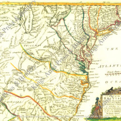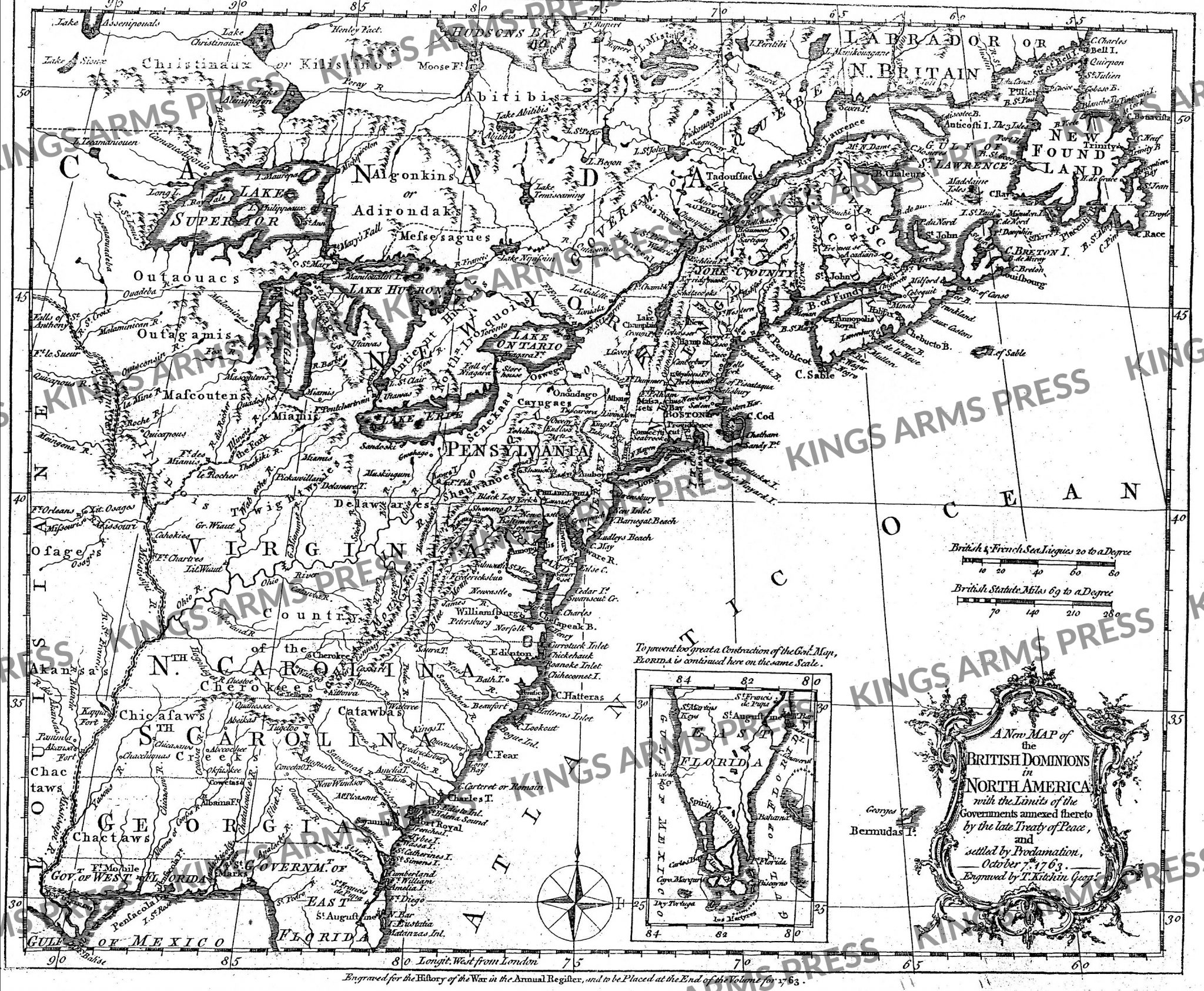
Map of the British Dominions of North America, 1763
$12.00
This handsome map, 18 x 24, printed on heavy chart paper shows the limits of the British territories established by the Treaty of Paris in 1763 and settled by proclamation. It is taken from The Gentleman’s Magazine of 1763, and was engraved by Thomas Kitchin.
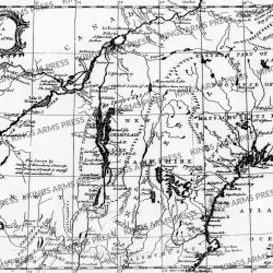
Interesting map of the US and Canada at the end of the French & Indian War, based upon John Mitchell’s seminal map of 1755.
The map shows the many French and English Forts in the Mississippi and Ohio Valleys, along with numerous Indian Tribes on either side of the Mississippi River. Nice detail throughout the map. This map appeared in the 1763 edition of the History of the War in the Annual Register.
Includes a large inset showing Florida as an Archipelago. Virginia, the Carolinas and Georgia extend to the Mississippi, although Pennsylvania extends west only to Ft. Pitt.
Thomas Kitchin was a British cartographer and engraver. He was apprenticed to the map engraver Emanuel Bowen from 1732 to 1739. A prolific engraver known for his technical facility, clean lettering, and impressive etched decorations. In 1755 Kitchin engraved the important John Mitchell map of North America, which was used at the peace treaties of Paris and Versailles.
Originals of this map have a price of $900 and up. A very attractive map with an inset of East Florida and an attractive cartouche. Watermark does not appear on purchased documents. These maps are oversize and are shipped in a mail tube and may require postage over and above your regular order.