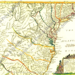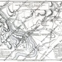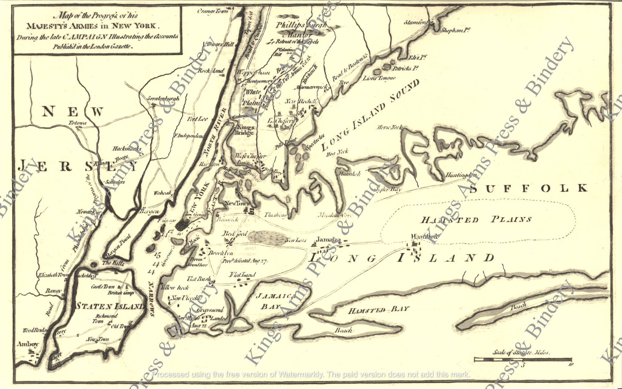
Map of the Progress of His Majesty’s Army in New York-1776
$5.00
The map shows battle details of General George Washington, including notes of General Howe’s landing on August 22, 1776, Provincials defeated Aug. 27. Retreat of the Rebels, and Provincials drowned here (near the Red Hook area of Brooklyn). The British placed General William Howe in charge of the greatest army England ever sent overseas, forces superior to any the Americans could put in the field.
In June of 1776, a large British war fleet led by Howe sailed into New York harbor. A month later an army of 10,000 men landed on Staten Island, unopposed by the Americans. All during July and August British reinforcements continued their build-up until Howe was in command of a combined force of 32,000 men, of whom 9,000 were German mercenaries. During the final days of August in the Battle of Long Island, Howe inflicted a crushing defeat on Washington’s army.
To escape the onslaught, Washington withdrew his colonial forces from Brooklyn Heights to Manhattan. Less than two weeks later he decided to evacuate New York City, rather than be trapped in lower Manhattan. However, before he withdrew from the city Washington prepared fortifications in upper Manhattan and was able to repulse the British army in the Battle of Harlem Heights. In October in the face of the advancing British forces, Washington evacuated his main force from Manhattan Island, leaving behind a garrison at Fort Washington, and marched to White Plains. In the Battle of White Plains the British inflicted heavy casualties on Washington’s army, whereupon Washington slipped away westward to North Castle on November 1, 1776.
Two weeks later the British forces under Gen. Howe captured the American garrison at Fort Washington, taking more than 2,800 prisoners. After deciding to abandon the New York area, Washington moved his forces across the Hudson River and into New Jersey. Joined by General Greene’s troops at Hackensack, they retreated together toward the Delaware River with General Cornwallis at their heels. The map was first issued in October 1776.
This is the more desirable second state of the map, issued in December 1776, which has been updated to include the position of the two armies at the battle of White Plains. This map is from the London Gazette of 1776 in our personal collection. It has been enlarged from the original and measures 11″ x 17″. It has been reproduced on imported laid paper and is suitable for framing, or for use in the field as part of an officer’s interpretation. Watermarks do not appear on purchased maps.