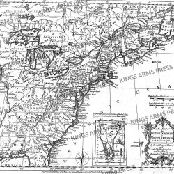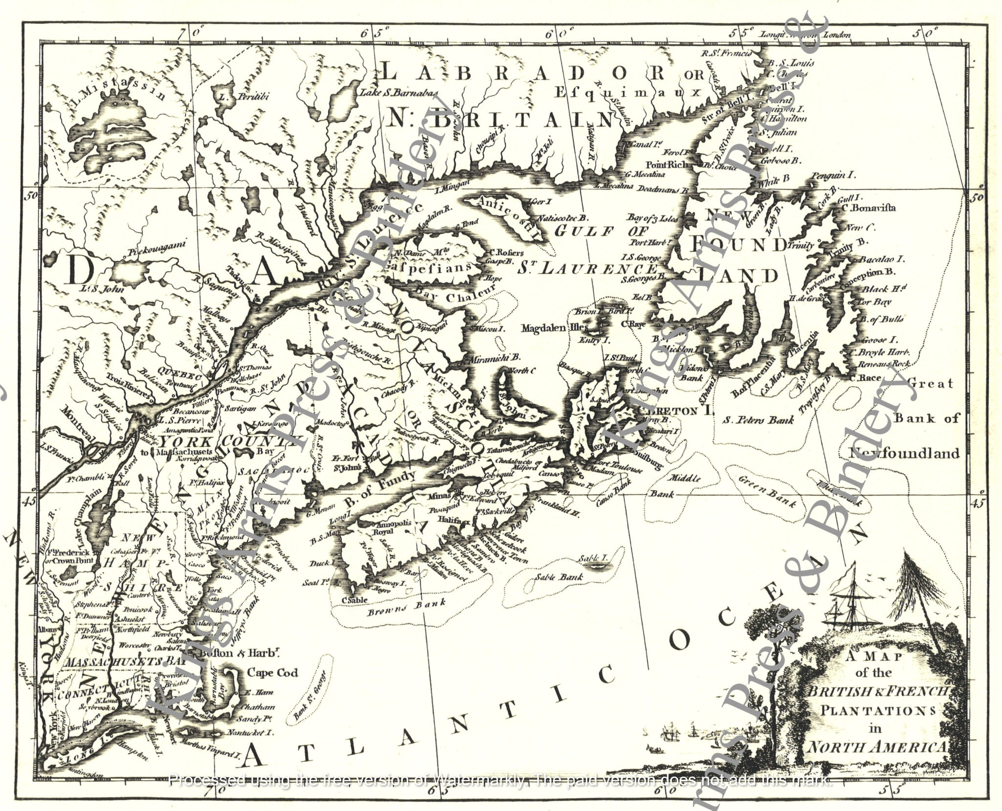
A Map of the British and French Plantations in North America-1755
$5.00
One of the earliest printed maps of the British Colonies to appear in a British Periodical.
Detailed early map of the British & French Colonies in North America, extending from Long Island and the Hudson River to the St. Lawrence, Newfoundland and contiguous parts of Labrador, centered on Nova Scotia.
The map identifies the New York and New England Colonies (New Hampshire, Rhode Island, Connecticut and Massachusetts Bay), along with New Found Land, Nova Scotia or Acadia, York County (consisting of the future Maine and Vermont-with Maine Prov noted as a small portion thereof) and a number of forts, towns, Indian tribes, etc.
Striking cartouche. A note below York County notes “to Massachusetts Bay.” Long Island is depicted as an island.
The map from the London Magazine of 1755, has been enlarged slightly from the original in our collection and measures 11” x 13.” It has been reproduced on imported laid paper and is suitable for framing, or for use in the field as part of an officer’s interpretation. Watermarks do not appear on purchased maps.