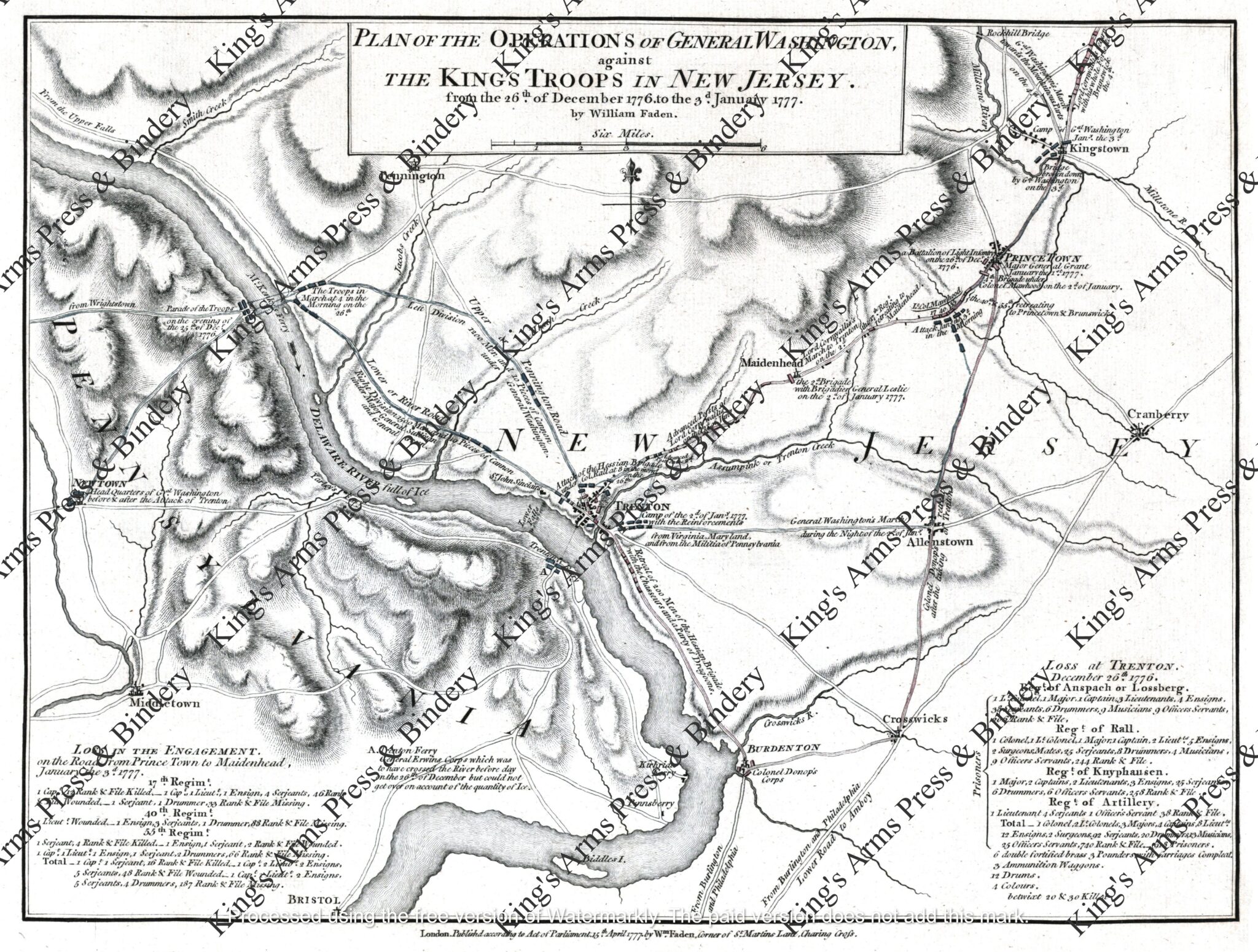
Map of the Battle of Trenton, William Faden, 1777
$5.00
This map depicts the operations of General Washington against the King’s troops in New Jersey. These operations occurred from December 26th, 1776, to January 3rd, 1777, and are collectively known as the Battles of Trenton and Princeton. This map was created by William Faden in London, 1777.
William Faden’s Plan of the operations of General Washington, against the Kings troops in New Jersey, from the 26th of December, 1776, to the 3d. January, 1777 was published in London on April 15, 1777. It was a detailed, commercially available, and historically significant map issued shortly after the events.
The map was published by Faden, a prominent British mapmaker and “Geographer to the King,” providing the British public with a detailed account of the American victory at Trenton. It was sold as a separate publication and did not appear in any publications such as the Gentleman’s Magazine
It depicts the 400 square-mile area of the Battles of Trenton and Princeton, showing the Delaware crossing, the attack on the Hessians, and British troop movements. The map is printed on French laid paper and measures approximately 11″ x 17″. $5.00
Watermark does not appear on purchased copies.